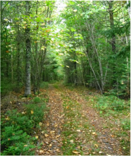
Since I live in Riverside-Albert, I’m sort of familiar with the trails around the village. But I decided to do some scouting around to see what the area had to offer. What I found were trails to suit all skill levels.
Heading south from Moncton, starting at Hillsborough, there is the White Rock Recreation area. This is a beautiful hilly part of the county, with a good mix of trails, many closed to ATVs. Some are double-track, some are single-track. Travelling on Highway 114, watch for the White Rock signs on the roadside.
The trails in White Rock are for those with at least intermediate skills. Some trails are difficult and the terrain is rugged and variable. Technical skills are needed for the ridges, sinkholes and inclines. “Heart-attack hill” is aptly named! See trail map on this site: https://www.facebook.com/pages/White-Rock-Recreational-Area-Hillsborough-NB/350636911683849?fref=ts
Also in this area are trails on the dykes, around the duck ponds, accessed behind the Information Centre. Easy trails, flat, and very picturesque.
Heading further south, there are the gravel trails on the dyke system in the Riverside Albert area. There are numerous access points to these trails. Easiest points for those not too familiar with the area would be at the Sawmill Creek covered bridge and Shipyard Park, in Harvey. These are flat trails that wind around the marsh area beside the river. Occasionally, you might encounter horseback riders out on an excursion from the local ranch. Protocol is that you dismount and stand by the side of the trail so that the horses don’t get spooked. While not a technical ride, it is beautiful.
The Trans-Canada trail also covers 12 km along the old railroad bed. Access points are in Shepody, right off Highway 114 and along Water Street in the village. This makes a pleasant family ride, suitable for all ages.
Caledonia Mountain Road and the trail up to the Crooked Creek lookout are two other options that are more challenging due to the elevation gain. The views from the tops are excellent. See trail maps on this site: http://www.crookedcreekadventures.com/bike-maps/
South of the village of Riverside Albert, you can take Highway 915 and Mary’s Point Road. This is paved road, except for a portion of Mary’s Point Road, past the bird sanctuary.
If you continue on Highway 915 towards Alma, you get to Dennis Beach, which has been described as “fat bike rad”. This is a long stretch of beach that provides huge swaths of sand, particularly at low tide. It is somewhat hidden, so you can be guaranteed that there will be few, if any, people there. You can have it to yourselves.
In the village of Alma itself, there is the Green Snake trail. Climbing 4 km from the village, it’s an out-and-back trail that is steady but not really steep or technical.
Fundy Park has a number of trails that can be biked. Ask at the Information Centre for a trail map. Two particularly have been reconfigured to meet IMBA (International Mountain Bike Association) standards. The most recent one is the Whitetail trail, which was described to me as being “the best mountain bike trail in Canada”. It’s a single track, shared with hikers, so caution is advised as you can pick up speed in some sections. Suitable for riders of at least intermediate skill, it’s a great 4 km run through the forest. Another is the Black Horse trail. A 4.4 km single track loop, this trail is great for bikers of all levels, and suitable also to get newcomers to mountain biking involved in biking. The name of this trail reflects the history of the old horse stable that used to stand at the trailhead. From Black Horse, other trails connect for a longer experience.
From beginner to experienced, Albert County has lots of trails for mountain bikers. Combine that with places to stay, campgrounds, restaurants, cafes, bars, shops, beaches and other outdoor activities, Albert County is a treasure trove!
Submitted by Susan Quinn
 RSS Feed